


This lovely piece of writing about the River Suir in Tipperary and the names of the fishing pools in the Golden area was contributed by Robert O’Keeffe of the Cashel, Golden and Tipperary Anglers Association.
The River Suir around Golden has always been an important trout and salmon fishery and there are a number of weirs on the water that date back, at least, to the 16th century and some that probably date back to the early days of Athassel Abbey. The river has played a vital role in the life of the community, both in terms of as providing a food source and, in latter times, as providing sport through angling.
The fishing fraternity have always been a community within a community, a small band of (mostly) men who seek the slow dropping peace that comes from fishing the river. Fishing, by its nature, is a relatively sedate pastime, one that encourages the angler to slow down and take the time to be in the now. The angler tends to have time to take stock, observe their surroundings and to become attuned to the rhythms and patterns of nature.
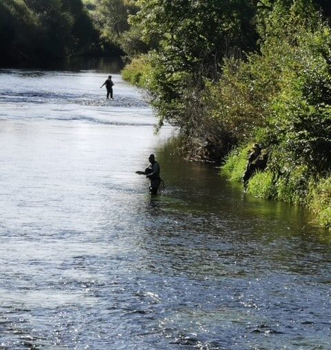
It is perhaps understandable, that, where most people see the river as a relatively featureless body, the angling community tend to know its contours, features and its moods on a more visceral level. The fishing community can meet and discuss the river in terms of natural features, and it would not be unusual to hear a conversation between two fishermen in Touhy’s Bar, talking animatedly about, “Meeting a fish under the sally branch that sticks out into the stream, at the top of English’s”. The intimate nature of a shared geography makes perfect sense to both, but would, no doubt, be incomprehensible to the listener.
The Cashel, Golden, Tipperary Anglers Association is one of the oldest clubs in the parish, founded in 1935. Its original officers were Maurice O’Connor, John St Cashel and Christopher Hogan, Athassel, Golden. Today, the club has around 140 members, drawn from all walks of life.
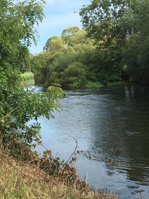
Besides the transitory natural features like trees and weed beds, that change each year with winter floods, there are, passed down through the generations, names that refer to the various unchanging natural and built features of the river. The pools and weirs along the river loom large in the lives of the fishing club and their names are taken from a variety of sources. Some take their names from the colour and texture of the water, others from historical figures or features associated with them; while others take their names from the families who owned the lands at various times in the past hundred years. These names have been passed down through the generations of fishermen and are largely unknown and unrecorded in the wider community. Some names have fallen out of common usage, while others are long forgotten. As older members have died out in recent times, there are fewer and fewer people who remember these names. This article seeks to record this information for future generations.
Taking the lands below Castlelake House as the boundary point of the parish, we first come to the Swimming Hole which stands in front of Ballinahinch Castle, and which was used for swimming lessons for the children of the area. Next, on the boundaries of the parish, we come to Keorish or McKeorish Hole, named after the one of the previous owners of the Bawn and Castle at Castlelake or Ballytarsny as it was previously known. The name Castlelake itself dates back to the early 18th century and refers to a clergyman, Matthew Leake, who lived here.
Below Keoirish hole, is Kennedy’s Flats, a long straight, slow and deep stretch of river that empties out into the Black Pool on John English’s land. At the bottom of this stretch, there was previously an island called Keating’s Island, which was drained and filled in many years ago. Here the river breaks into three and the larger of the two islands, grazed in summer by cattle who cross the river, is Kelly’s Island, which was also known as Duck Island.
Just below where the strands of the river meet again, is Kelly’s Slip and the small grove of trees that stand beside it are Kelly’s Wood.
Just below this, the remains of a bridge can be seen with the anchoring points still in place on both sides of the river. An old, raised roadway runs through this field which would have meant the flood plain could be travelled in the winter floods. This feature is known as the High Wall and there are two schools of thought as to its use. Some argue that this was the original road between Dundrum and Cashel, while others posit it may be an old estate road. Eddie Dalton says that Arthur Young in his book “A Tour of Ireland”, speaks of taking a tour of the Mantlehill estate in the 1770s with Lady Clanwilliam and they crossed the river, most likely at this point. Canon O’Dwyer, reminiscing in the 1980s, remembered the bridge being washed away in the 1920s. Dennis O’Donnell recalls this part of the river being known as the Wooden Bridge and says that the timber pylons from the bridge could still be seen there until comparatively recent times.
The pool that marks the boundary between Michael Fogarty’s and Eamonn Carr’s land was named Moran’s Wood, in reference to a wooded area that stretched along this spot, on the opposite bank, in times past.
A few hundred metres below this, in Larry Moloney’s land, the river again runs into a deep pool that is known as the Black Pool. Old maps mark an Osiery (willow plantation) at the other side of the river in the 1840s.

Just below this lies the Rock Well on Padraig O’Dwyers land. This well was the main source of clean drinking water for the people of Mantlehill and was in use until running water was finally provided to the townland in the 1950s. Denis O’Donnell recalls that this point of the river was always known to fishermen as The Farmyard. In this stretch, covered by water except in the most extreme drought conditions, is the remains of the Head Weir. This weir was used to divert water into the Mill Stream which runs from here to Golden Village and which was used to drive the mill wheel there.
Around the corner from the Mill Stream a small pool known as the Little Pig’s Hole. This then washes down into the deep dark waters of the Pig’s Hole. The river just below the Pig’s Hole, gets shallower again and branches around a small island known as Tea Island.
The river then picks up speed and races down towards one of the old crossing points of the river at Byrne’s Ford.
One of the best-known spots on the river is the Moat where the River Multeen meets the Suir. This has been a strategically important point of the river for thousands of years. It is a natural salmon pool, holding fish as they make their way up both rivers to spawn. The Moat probably refers to the archaeological feature on the edge of the river where the bench now sits. Across from it, on the Mantlehill side, the high esker holds the remains of two Iron Age hilltop forts. The Moat is a popular swimming spot for locals. The pool in front of the Moat is known as Moran’s Pool.

Older sources recall that this may been the site of Maol Cheannaigh, where the progenitor of the McCarthy’s defeated the men of Ossory and Ormond in 1043.
The Moat flows out in the quicker waters that fishermen would refer to as being Under the Well, referring to Chadwick’s Well.
Further down the river, on the Castlepark side, we find the site of the Boathouse. Dennis O’Donnell remembers that the foundations of the boathouse could be seen here and that there were skiff type boats used here that could be poled up and down the river.
As the river glides on towards Golden, we come to Murray’s Hole. This was another popular bathing spot. Patrick O’Brien remembers a diving platform built here, the foundations of which lie buried under the bank. The name derives from Poll Muridh, which translates as the Leper’s Hole. This refers to a medieval leper colony which stood at this spot. The townsland here is Monkscell and there was, until the 1930s, the remains of 12 cells inside a high wall, which were probably used to house the lepers.
The right-hand bank from here to Golden is known as Castlepark, from the original Castlepark House, which was later renamed Mantlehill House and owned by the Scully family. One of the more unusual surviving names from this time, associated with the Scully family, is the Ha-Ha. A Ha-Ha is an architectural feature which has a deep ditch, with a wall on its inside side and a slope upwards on the other side. They were used to form a fenceless boundary to a garden, a way of keeping animals out without interrupting the view.
In the village, on the Castlepark bank, beside where Lawrence’s house is now, was a feature known locally as The Bars. These were a series of girders which offered a precarious crossing of the drain that traversed this field.
As we leave the village, the stretch of water that runs down from here, on the village side of the river, is known as the Lacken and it has always been a popular spot for trout angling. Below this is Hannah Mary’s weir, the first of several weirs that dot the river between here and Ballycarron. Not far below Hannah Mary’s about forty yards back from the bank is the site of Cooke’s Well, which Eddie Dalton remembers drawing water from as a child. A stream flows from the well into the river.
About a half mile from here the river slows down and runs into the Rock Pool which had always been a prolific salmon fishery. Sadly, salmon numbers have been dwindling at an alarming rate for the last thirty years and the salmon teeters on the brink of extinction. The pool empties out here, thundering over Moloughney’s or Cahill’s weir. About a hundred metres below the weir, we come to the Well, a spring well that was used until modern times for drinking water. Below the well the water levels out into the Elm Tree Pool.
The river then flows gently past Athassel Abbey. The abbey translated as Ath Iseal means the low ford. The fording point in the river here is easily waded and would have been a natural crossing point for the community attached to the abbey. The remains of the moat, built by the monks, who diverted the river around the Abbey and who practiced fish farming at the site, can still be plainly seen. Somewhere in this locality another weir was recorded. An article by A.E.J. Went records that ,
‘Adjacent to the abbey of Athassel there were a number of fishing weirs at the time of the Civil Survey. In the parish of Relickmurry there were two weirs, one in the townland of Athassel Abbey being “commonly called the black weir “. The exact whereabouts of these weirs is again unknown but there are a series of fords below the abbey which would have been suitable for the erection of eel weirs and there is today a mill dam somewhat upstream. On 20th June 1634 indentures were entered into by James, Earl of Ormond and others on one hand and Doctor Gerald Fenall for a lease for 31 years, dating from the death of Ellen Countess Dowager of Ormond of “the weir commonly called the Black weir.’
Below the Abbey is a small pool that was once known as the Mo Tree Pool but this name has fallen out of modern usage. The far bank of the river, across from Athassel is known as the Suir Road by the angling community.
Below the abbey the river runs into a deep pool, locally known as the Priest’s Pool. This pool flows out into Russell’s Slip, a traditional access point to the river.
We next encounter Jackman’s Weir, a spectacular site with water thundering ceaselessly through. This weir is the property of the Jackman family and they have lovingly tended it for the best part of a hundred years. The bench here must surely rank as one of the most peaceful places in the parish and is a fine spot to watch the world go by.

Below the weir, the water glides down through the valley at Quinlan’s Slip and this is a very important and prolific habitat for wild brown trout. The river then powers through the picturesque rapids at what was known in recent years as the Swissman’s Weir. This refers to Kurt and Enid Stamm whose house hung on the hill above the weir. Its purpose-built sauna and goats with bells, lending an alpine touch to the river while they lived there.
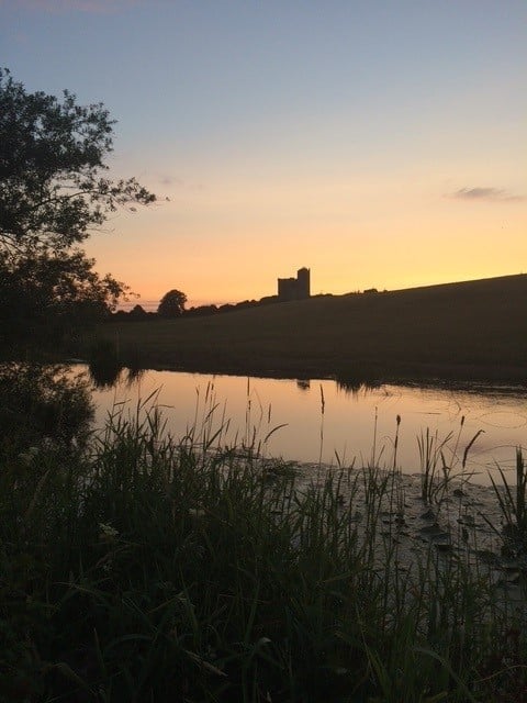
Next along the river is O’Malley’s weir which nestles below the impressive remains of O’Malley’s Castle or Suircastle. This castle is a four-storey tower house, possibly dating to the fifteenth century. Its proprietor in 1640 was “John Cantwell of Mocarky Esquire, Irish papist” . It was also later the site of the home of Baron Massey who built a mansion there which has since been demolished, with few traces remaining.
The rapid waters slow after this and empty into the Bishop’s Pool, which then flows into a tree lined run that continues down towards Ballycarron. Just before the bridge at Ballycarron, we find the Windmill Hole, taking its name from the remains of the windmill that stands on the riverbank and that marks a very early effort at harnessing wind energy to pump water.
Our club waters end just below Ballycarron Bridge. The bridge itself is an impressive edifice and had to be rebuilt after being blown up during the Civil War in Autumn 1922. A replacement timber bridge was also destroyed in March 1923.

The information in this article was kindly provided by the following people, who generously shared their time and their huge knowledge and provided us a unique window to our historical, living landscape.
1. Denis O’Donnell
2. Patrick (Pakie) O’Brien
3. Michael Doyle
4. Eddie Fitzgerald
5. Willie Boles (Senior)
6. Ciarán and Christy Ryan (Preston)
7. Eddie Dalton


