


At the upstream limit of the Erne navigation, the historic town of Belturbet has a long track record in angling tourism and continues to provide an excellent base for the visiting pike angler.
The angling centre at Belturbet draws mainly on the resources of Lough Oughter and Upper Lough Erne. There are still many bays and backwaters to be explored on these fantastic systems and pike anglers of all levels will find a great variety of waters to meet all of their expectations and aspirations.
Upper Lough Erne

Map: Upper Lough Erne Bathymetry Map
Upper Lough Erne is one of the principal pike angling resources for the above angling centre and covers an area of circa 1,552 hectares. This lake offers very good pike fishing with many pike over 30lbs recorded annually. There is a large network of lakes offering excellent bank and boat fishing and there are a number of well established pike waters including the River Erne, Upper Lough Erne and satellite lakes. This is joint jurisdictional water which straddles the border with Northern Ireland. Visiting anglers should acquaint themselves with the legislative requirements for fishing in Northern Ireland.
The stretches of the River Erne located north and south of Belturbet each have different characteristics. The 7km stretch located upstream of Belturbet to Bakers Bridge comprises a series of deep pools linked by smooth shallow glides. The 8km downstream stretch below Belturbet is part of the Erne navigation and is generally deep and slow flowing. Some wider sections are to be found along its course.
The river produces good catches of pike including fish to over 20lbs to all methods. Pike are well dispersed throughout the system but can be concentrated in certain areas especially prior to spawning. The seasonal movements of fodder fish also influence the numbers of pike present at certain times of the year. On the stretch above the town bank fishing is the norm whilst boat fishing is more widely practiced below the town. Access is available at various points between Bakers’ Bridge and Belturbet namely at Bessbrook (1) and Putiaghan (2). Good roadside parking is also available.
From Belturbet to Upper Lough Erne access is available at “the lawn” (3) in the town where parking and a boat slipway are also provided.
Fishing is available from the various public jetties in the town. Anglers should be aware that the primary purpose of these jetties is to facilitate the mooring of cruisers and pleasure craft. Access is available at various points between Belturbet and Upper Lough Erne namely at Noghan (4), Loughdooley (5), Clowninny (6), Foalies (7) and Derryvoney, River Erne (8). Off-road car parks are located within walking distance of the river at all of these locations. In addition there is also a lake side car park at Upper Lough Erne at Derryvoney (9). The southern shore at Derryvoney is generally shallow but deep water up to 7m exists close to the shore to right of the car park.
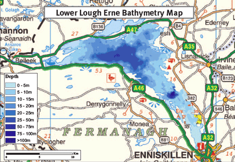
Map: Lower Lough Erne Bathymetry Map.


